PROJECTION EXPLAINED
The Equal Earth Projection, Explained
Equal Earth turns longitude and latitude into a flat world map while keeping the relative area of every region consistent. Its appeal lies in combining that mathematical promise with a legible, balanced silhouette.
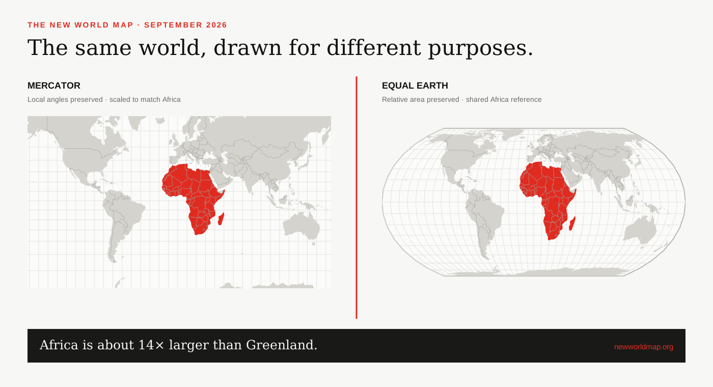
A projection is a set of choices
Earth is approximately spherical; screens and printed pages are flat. Moving between those surfaces means stretching, compressing or cutting the geography. Projection families are defined by the properties they preserve and by the geometry used to construct the flat coordinates.
Conformal projections protect local angles. Equal-area projections protect relative surface area. Equidistant projections keep selected distances true. A world map cannot preserve all three everywhere, so technical accuracy begins by stating which property matters for the job.[3]
How Equal Earth was designed
Šavrič, Patterson and Jenny developed Equal Earth as an alternative to equal-area projections whose stretched shapes can discourage general use. Their 2018 paper defines a closed-form projection with straight parallels, a straight central meridian and curved outer meridians.[1]
The result resembles Robinson at a glance, but the mathematical behaviour differs. Robinson is a compromise: it distributes several kinds of distortion without exactly preserving a single global property. Equal Earth guarantees equal area throughout.[2]
What ‘correct size’ means
Correct size means proportional mapped area, not an identical outline. If Africa covers about fourteen times Greenland’s surface area, its shape covers about fourteen times as much space on an Equal Earth map. Coastline shapes still bend because area preservation does not preserve every local angle.
A screen can introduce another layer of confusion. Zooming two projections to unrelated extents makes pixel footprints incomparable. This site uses matched panel dimensions and a shared geographic viewport so that its screen-area comparison has a stated, repeatable basis.
Using Equal Earth in software
Equal Earth is widely implemented in contemporary geospatial software and is registered as EPSG:8857. On this site, D3’s geoEqualEarth implementation projects the same Natural Earth coordinates used in the Mercator panel.[2][4]
For serious measurement, keep calculations on a geodesic or suitable regional coordinate system rather than measuring lengths from a small world map. Equal Earth makes area patterns visually honest; it is not a substitute for a survey-grade workflow.
SOURCES & REVIEW
Sources for this article
We link to primary institutional material where possible and keep projection-dependent screen area separate from official statistics and boundary-derived geodesic estimates.
- Šavrič, Patterson and Jenny, The Equal Earth map projection (2018) ↗
- Equal Earth projection project and technical overview ↗
- UN Statistics / UNGEGN guidance on choosing map projections ↗
- D3 geographic projections documentation ↗
Published 2026-09-08 · Last reviewed 2026-09-15. News and institutional claims were checked against the cited record on the review date.
Read our method and editorial standards →