UN MAPS, UNTANGLED
UN World Map: What the UN Approved in 2026
Searches for a ‘UN world map’ often combine three different things: a 2026 General Assembly recommendation, maps published by UN Geospatial, and the polar map inside the United Nations emblem.
THREE DIFFERENT OBJECTS
“UN world map” does not mean one projection.
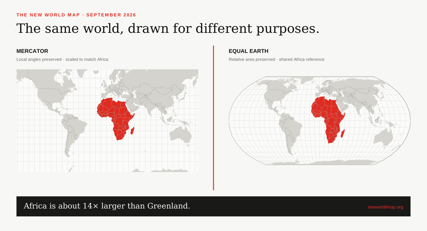
The 2026 resolution recommends an equal-area view for size comparisons. The UN emblem uses polar azimuthal geometry, while individual UN publications choose projections for their own purpose.
What the United Nations approved in 2026
On September 4, 2026, the General Assembly adopted the Africa-led ‘Correct the Map’ resolution by 164 votes to one, with six abstentions. The text encourages governments, international organizations, schools, publishers and digital platforms to use Equal Earth or another equal-area projection when a world map is meant to compare relative size.[1][2]
A General Assembly recommendation is influential but not a binding technical standard. The vote did not outlaw Mercator, alter borders or require every map to use Equal Earth. Navigation, regional mapping and operational work can still call for other projections.[1][3]
Is there one official UN world map?
No single projection serves every United Nations map. UN Geospatial publishes general world maps and many thematic or operational products, while projection choices vary with purpose, scale and region. Its July 2026 general map of the world is a specific publication, not a universal template that every UN office must copy.[4][5]
The 2026 resolution changes the recommended default when relative area is the message. It does not make projection mathematics responsible for names, boundary lines or territorial status; those remain decisions of the dataset and map publisher.
The UN emblem uses a different projection
The world map inside the United Nations emblem is an azimuthal equidistant projection centred on the North Pole and extending to 60 degrees south. The General Assembly approved that emblem design in 1946. It is a symbol of the organization, not the Equal Earth projection discussed in 2026.[5]
An azimuthal equidistant map preserves distances and directions from its centre. Equal Earth preserves relative area across the whole map. Mercator preserves local angles. The three silhouettes look different because they were designed to do different jobs.
How to read an ‘UN-approved’ map claim
First ask whether the claim refers to the 2026 resolution, an actual map published under the UN imprint, or the UN emblem. Then check the projection name, publication date and boundary disclaimer. A social image labelled ‘approved by the UN’ may summarize the resolution without itself being an official UN publication.
For size comparisons, verify that the map is genuinely equal-area and that two images have not been fitted to unrelated frames. The comparisons on this site use the same Natural Earth boundaries and normalize both projections around Africa so their screen footprints have a disclosed basis.[6]
SOURCES & REVIEW
Sources for this article
We link to primary institutional material where possible and keep projection-dependent screen area separate from official statistics and boundary-derived geodesic estimates.
- UN General Assembly draft resolution A/80/L.104 ↗
- UN General Assembly, 80th session, 114th plenary meeting ↗
- Associated Press report on the UN General Assembly vote ↗
- United Nations Geospatial — Map of the World, July 2026 ↗
- United Nations Geospatial — map projection FAQ ↗
- Natural Earth 1:50m cultural vectors ↗
Published 2026-09-08 · Last reviewed 2026-09-15. News and institutional claims were checked against the cited record on the review date.
Read our method and editorial standards →