INTERACTIVE ATLAS
Equal Earth Map
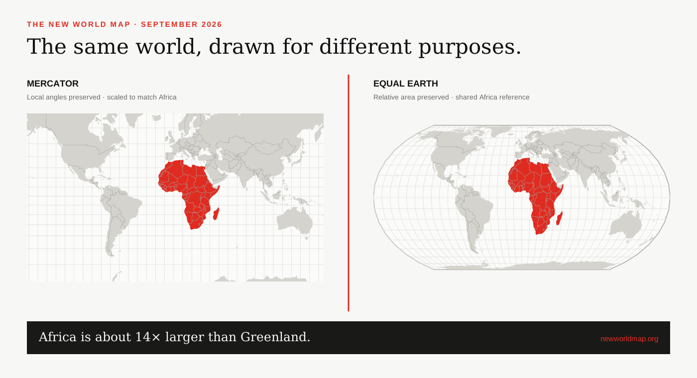
Equal Earth is a modern equal-area projection designed to keep the relative sizes of countries and continents correct without giving the world an unfamiliar, severely stretched outline.
What makes Equal Earth different
Equal Earth is a pseudocylindrical, equal-area projection introduced in 2018 by cartographers Bojan Šavrič, Tom Patterson and Bernhard Jenny. ‘Equal-area’ is the important part: a region that covers one per cent of Earth’s surface also occupies one per cent of the mapped area, after allowing for the overall map scale.[1][2]
The design deliberately resembles the rounded Robinson projection, a familiar compromise map, while adding rigorous area preservation. Straight parallels make north–south position easy to follow, and curved outer meridians hint at the planet’s spherical form.[2]
What it preserves—and what it cannot
Equal Earth is the right tool when the visual comparison depends on area: climate zones, population density, forests, voting blocs, disease prevalence or the relative scale of continents. United Nations and International Cartographic Association guidance recommends equal-area projections for world thematic maps whose patterns are normalized by area.[3]
It cannot keep every coastline shape, direction and distance exact. No flat projection can be both conformal, preserving local angles, and equal-area. Shapes change most near the outer edges of an Equal Earth map; routes that look straight are not necessarily the shortest paths on the globe.[4]
Equal Earth is not a political boundary map
A projection supplies coordinates, not political judgments. The same Equal Earth mathematics can render different boundary datasets. Questions about disputed territories, naming conventions and recognition belong to the chosen source data and editorial policy, not to the projection itself.
This site renders Natural Earth’s public-domain 1:50m country geometry. It uses de facto boundary conventions suitable for small-scale world maps. Those lines may differ from maps published by national governments or international bodies, and tiny territories can fall below the source dataset’s polygon resolution.[5]
When to choose this map
Choose Equal Earth for a wall map, classroom overview, global data story or any comparison where a reader should judge relative land area. Choose a local projection for surveying or regional measurement, a globe for an undistorted overview, and Mercator when preserving local angles or using conventional slippy-map tiles is essential.
The linked map above lets you test the trade-off rather than accepting it on trust. Select a country near the equator, then one at a high latitude, and compare how its Mercator footprint changes against the equal-area view.
SOURCES & REVIEW
Sources for this article
We link to primary institutional material where possible and keep projection-dependent screen area separate from official statistics and boundary-derived geodesic estimates.
- Šavrič, Patterson and Jenny, The Equal Earth map projection (2018) ↗
- Equal Earth projection project and technical overview ↗
- Mapping for a Sustainable World — United Nations and International Cartographic Association ↗
- UN Statistics / UNGEGN guidance on choosing map projections ↗
- Natural Earth 1:50m cultural vectors ↗
- D3 geographic projections documentation ↗
Published 2026-09-08 · Last reviewed 2026-09-15. News and institutional claims were checked against the cited record on the review date.
Read our method and editorial standards →